↓ Skip to Main Content

Secondary Navigation

TurkeyRiver.org

Main Navigation

  • Home
  • Water Quality + Flood Reduction
    • Watershed Alliance
      • Watershed Alliance: Sep 2011
    • Watershed Management Authority
    • Watershed Resiliency Plan
    • Iowa Flood Center Project
    • Maps/GIS Analysis
    • Photo Tour
    • Presentations & Publications
    • Water Quality Sampling
    • Watershed Projects within the TRW
  • Watershed Management Authority
    • Watershed Resiliency Plan
  • Recreation
    • Camping
    • Canoeing & Kayaking
    • Fishing
    • Turkey River Recreational Corridor
    • Turkey River Water Trail

Author: Brad Crawford

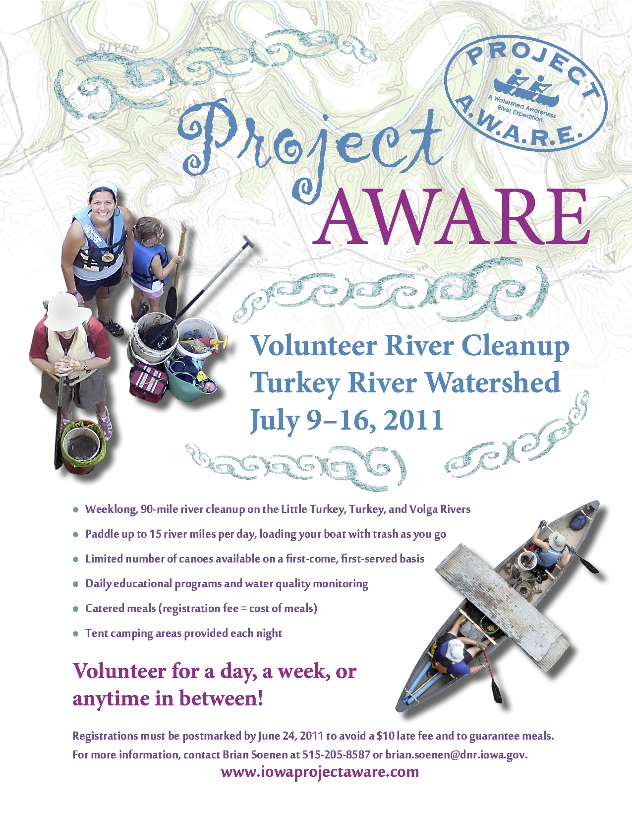
Clayton County Conservation Awareness Network

By Brad Crawford Posted on March 16, 2011 Posted in Organization

Clayton County CAN is a brand new non-profit organization and grassroots network with a vision of creating a more unified and inspired voice for conservation and the generations to come.

Learn more at www.claytoncountycan.com, and consider attending the next event or meeting.

Related Images:… Read more ›

Project AWARE July 9-16, 2011 Little Turkey, Turkey & Volga Rivers

By Brad Crawford Posted on March 15, 2011 Posted in Event
Project AWARE  July 9-16, 2011  Little Turkey, Turkey & Volga Rivers

Project AWARE is a volunteer river cleanup. Take part and you’ll be among hundreds of volunteers cleaning up the river, having fun, and making a difference in your watershed.

  • Learn more at: www.iowaprojectaware.com
  • Get Registered (PDF)
  • Find out what it means to become a sponsor (PDF)


Related Images:… Read more ›

Turkey River Water Trail

By Brad Crawford Posted on March 10, 2011 Posted in Water Trail No Comments
Turkey River Water Trail

The Turkey River Water Trail Map & Guide is now available for download in PDF format. This pocket-sized guide is also available in print and can be ordered online or picked up at several Northeast Iowa locations.

Related Images:… Read more ›

Posts pagination

Previous 1 … 3 4 5
Error retrieving: http://waterservices.usgs.gov/nwis/iv?format=waterml&sites=05411600,05411850,05412020,05412500,05412340,05412400¶meterCd=00060&siteType=ST